Madagascar’s Cyclone Gamane—The Devastating Storm Nobody’s Talking About

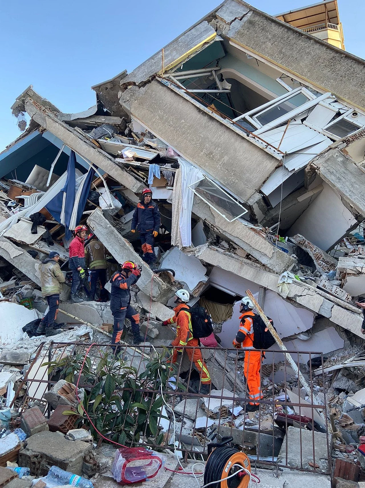
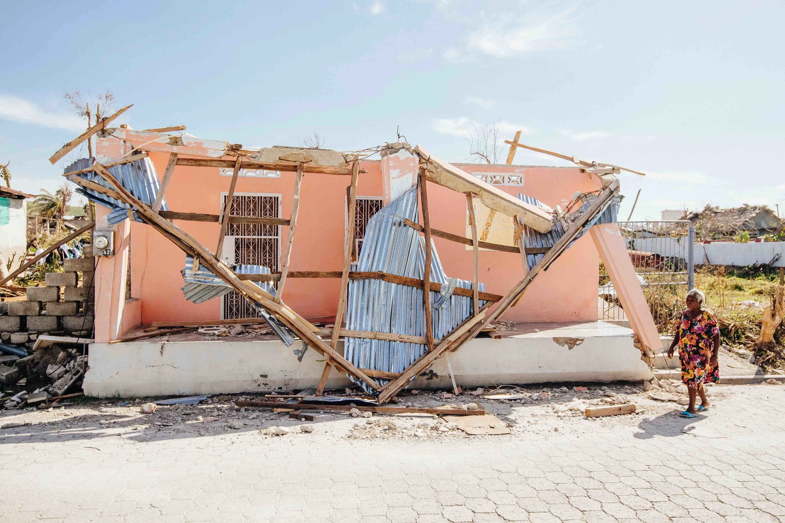
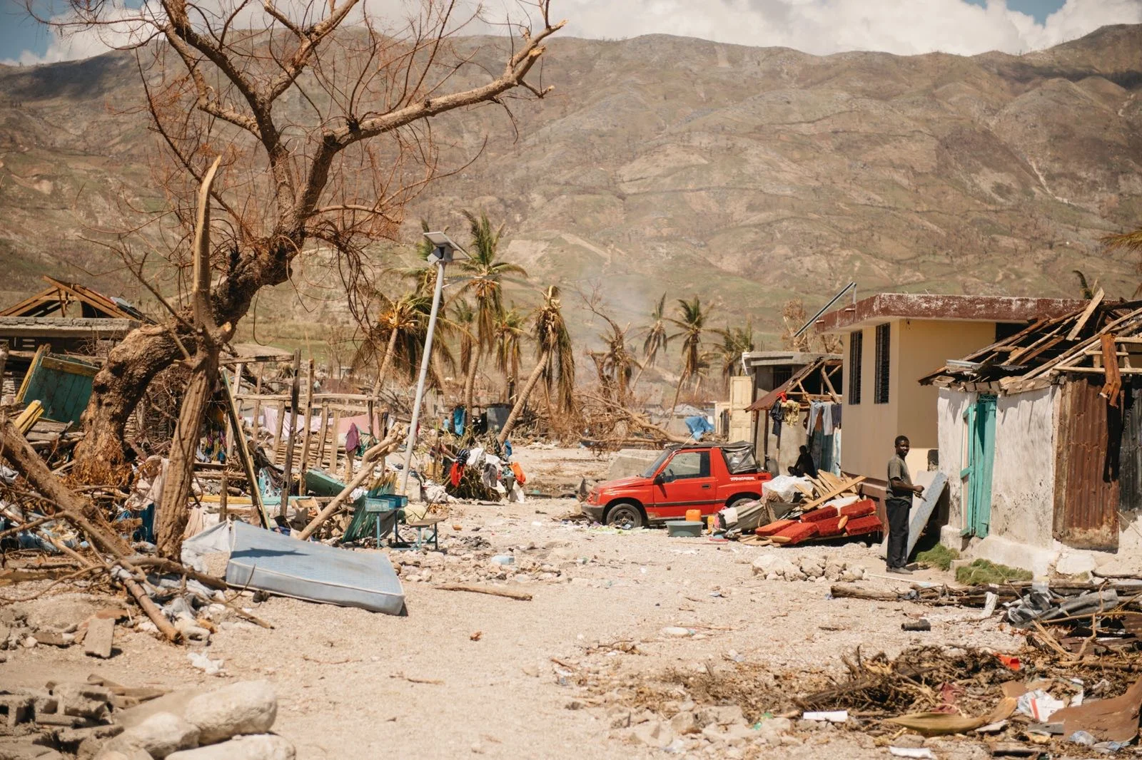
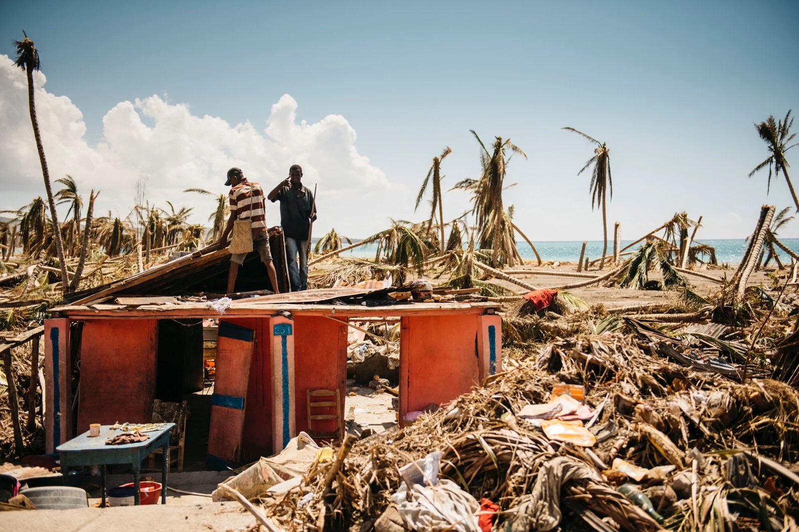
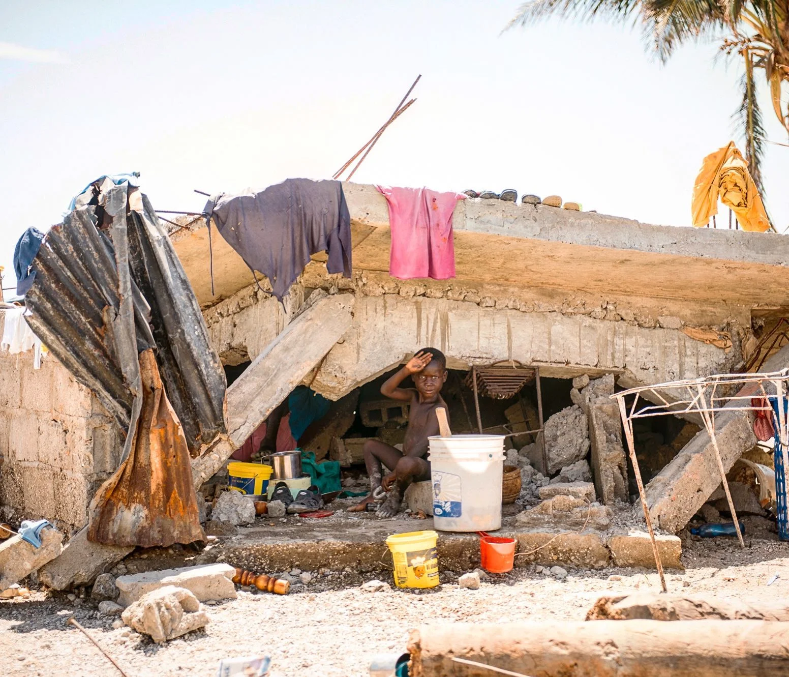
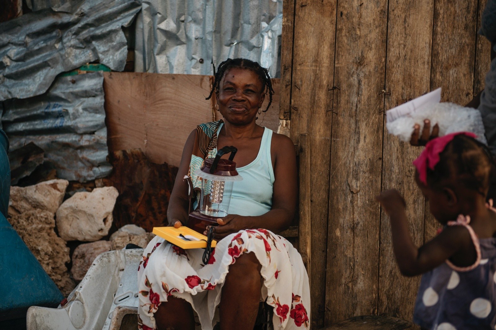
Thousands of homes were destroyed and families displaced, with almost no American news coverage.

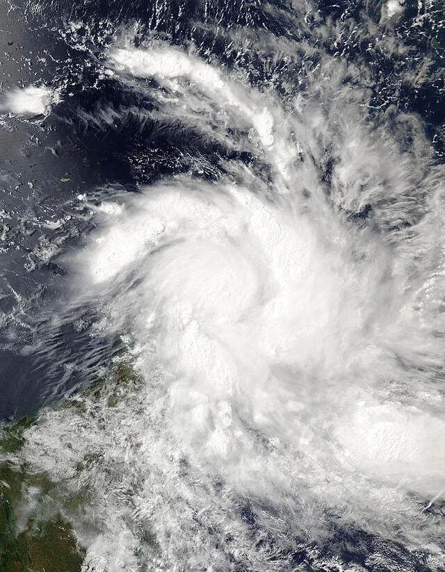
Cyclone Gamane over Madagascar. NASA, CC0

A few weeks ago, Cyclone Gamane made landfall on Madagascar. It devastated the island in no time flat, leaving tens of thousands of people homeless and without food or electricity. It arrived on March 27th; the government declared a state of emergency on April 3rd. And despite all of this, there was almost no American news coverage about the disaster.

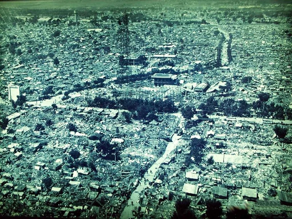
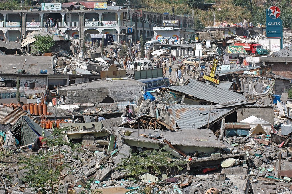
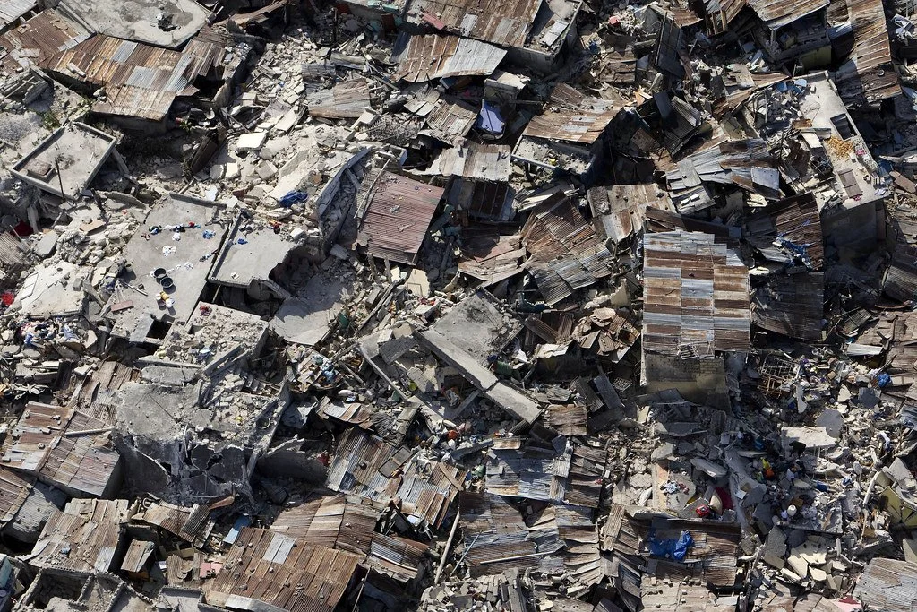
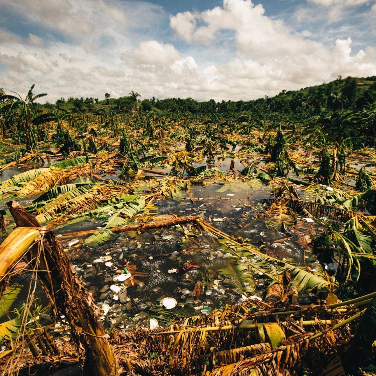
Gamane began as a tropical cyclone over the South Indian Ocean. By the time it reached Madagascar, its wind speed was clocked at an average of 93 mph, with gusts up to 130 mph recorded. Thirty-three communes were flooded in the three days it pummeled the northern coast, and more than 780 houses were destroyed. Eighteen people were killed and more than 22,000 were displaced from their homes. Estimates suggest that there are roughly 220,000 people in need of humanitarian assistance on the island.

Even before the cyclone, Madagascar was numbered among the worst off in the Global Hunger Index in 2023. Before the flooding in February and with Gamane, much of the island was unable to produce enough food to support the population. Roughly 1.6 million citizens are food insecure, relying instead on humanitarian aid. Additionally, the cyclone came at the beginning of Madagascar’s notoriously dry lean season, which lasts from late March until May. If conditions don’t improve quickly, there are concerns that large chunks of the country will experience crisis-level food insecurity.

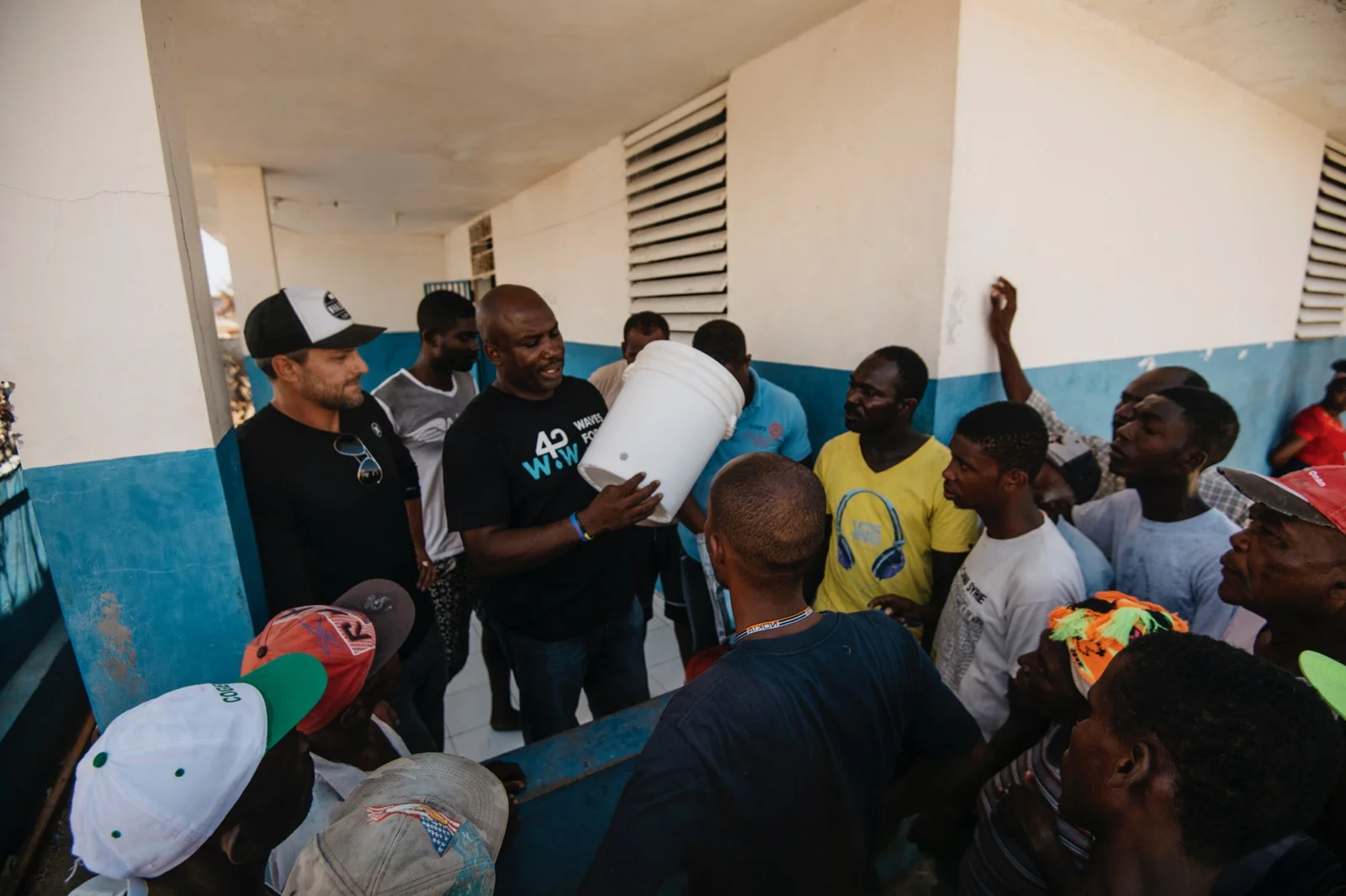
Emergency supplies on the island are already low—Gamane is only the third crisis to hit Madagascar in 2024, after the Alvaro storm in January and heavy flooding in February. Local humanitarian associations have made efforts to help the populace recover, but without resources, the government has had to call for aid from other countries.

The UN has set up a funding program under the CERF, the Central Emergency Response Fund, to accumulate funds to send to Madagascar. As of April 21st, the program is 20% funded, and is seeking to raise 90 million dollars. Smaller humanitarian organizations, such as the Redemptorist Solidarity Office (headquartered in Cork, Ireland), have taken action in the meantime to provide what help they can. According to their website, the RSO has provided 15,000 pounds for financial support and is shipping several tons of food items and medical kits. They hope to raise enough money to help provide shelter-building supplies for the displaced as well.

Madagascar is uniquely situated as one of the most susceptible places on Earth to natural disasters. Over the last 35 years, more than 50 hazards, including locust swarms, droughts, and heavy flooding, have struck the country and affected nearly half of the entire population. This has, to some degree, resulted in less coverage being dedicated to each event; even now, almost a month since the storm first made landfall, it has received very little publicity in the United States. But despite this lack of interest, humanitarian action is still being taken. It will be an uphill battle, between the fallout from the storm and the height of the lean season approaching, but with the help of the UN and other independent aid groups, Madagascar can and will recover.

Get Involved

At the moment, due to the lack of publicity that the crisis has received in the US, there are not many volunteer opportunities within the country. Those looking to help can donate to SEED Madagascar (which seeks to combat food insecurity), UNICEF Madagascar (which is working to minimize the effects of climate change on the island), or the World Food Programme’s Madagascar mission (which aims to supply over 1.6 million people with humanitarian assistance).


Ryan Livingston

Ryan is a senior at The College of New Jersey, majoring in English and minoring in marketing. Since a young age, Ryan has been passionate about human rights and environmental action and uses his writing to educate wherever he can. He hopes to pursue a career in professional writing and spread his message even further.

Beyond the Quakes: Taiwan’s Earthquake Preparedness

Despite being hit with a 7.4 magnitude earthquake during rush hour on April 3rd, 2024, Taiwan has emerged largely unscathed. Why is that?

A seismogram of the April 3rd, 2024 earthquake in Taiwan. James St. John. CC BY 2.0 

On April 3rd, 2024, the strongest earthquake in about 25 years rocked the streets in and around Hualien on the east coast of Taiwan, followed by hundreds of aftershocks. While the search for survivors remains underway, so far 13 people have been found dead, and nearly 1,000 people have reported injuries. While any number of deaths and injuries is tragic, these figures are minuscule compared to the near 2,500 dead and 100,000 injured during the 7.7 magnitude earthquake that struck in 1999 and left approximately 50,000 homes destroyed.

Considering its location along the Ring of Fire and the presence of three seismic belts in the country, Taiwan has a long history of earth-shaking events. The Ring of Fire refers to a fault line around the Pacific Ocean that is home to a majority of the world’s earthquakes. Because of this, Taiwan records an average of about 2,200 earthquakes every year, with a record of nearly 50,000 during 1999. Taiwan’s mountains then amplify the impact of earthquakes, which resulted in the landslides that accounted for most of the deaths on April 3rd.

Because of this susceptibility and catastrophic earthquakes in the past, Taiwan has developed some of the best earthquake preparedness techniques in the world. Following the devastating Chi-Chi earthquake in 1999, the Taiwanese government began reforming construction regulations. This included seismic retrofitting in buildings and infrastructure across the country and the prosecution of inadequate construction practices. Years of experience have also resulted in efficient emergency response, aided by surveillance cameras and social media used to identify locations requiring aid. 

Educating the public has been another initiative to prevent deaths during earthquakes and aftershocks. In addition to public awareness campaigns, the Central Weather Administration frequently publishes resources including information and tips surrounding earthquake preparedness. The Central Weather Administration has also run a real-time seismic network since 1994, which tracks data and notifies the public of seismic activity through an early warning system. The data collected by the seismic network is also used to update building codes.

GET INVOLVED

Ways for people to support Taiwan’s emergency response and earthquake preparedness include donating to and supporting organizations such as the Red Cross, Taiwan Root Medical Peace Corps and Peace Winds America.


Madison Paulus

Madison is a student at George Washington University studying international affairs, journalism, mass communication, and Arabic. Born and raised in Seattle, Washington, Madison grew up in a creative, open-minded environment. With passions for human rights and social justice, Madison uses her writing skills to educate and advocate. In the future, Madison hopes to pursue a career in science communication or travel journalism.


10 Natural Disasters that Shook History

Witness the awe-inspiring forces of nature unleashed through devastating hurricanes, volcanic eruptions and catastrophic floods.

The recent havoc wreaked by a wildfire in Hawaii has turned the once-idyllic summer paradise into a scene of devastation. The ferocity of another’s sweep through British Columbia and the Northwest Territories stands as a stark testament to the awe-inspiring might of Mother Nature. In contemporary times, we find ourselves confronting an array of astonishing extreme weather events and disasters. From heart-rending floods in California to merciless storms battering Mississippi, and the earth-shattering earthquakes that shook Afghanistan, these events underscore the delicate balance between human society and the natural world.

Throughout the annals of history, spanning various epochs of human progress, we encounter a recurring theme of dramatic weather and geological upheavals. Presented below are six far-reaching instances of natural disasters, each demanding a profound respect for the forces of nature.

1. The Great Hurricane of 1780

Caribbean Islands

Egmont Robt Fanshawe Esqr, Commander, when dismasted in the Great Hurricane on October 11th 1780 near the Island St Lucia. Royal Museums Greenwich. CC0.

Among the most catastrophic events etched in the annals of the Atlantic Ocean is the Great Hurricane of 1780, a tempest that swept across the Caribbean archipelago and left in its wake a death toll that neared 22,000 victims. The island of Barbados, nestled among the Lesser Antilles and situated to the north of Venezuela, bore the full brunt of this storm’s wrath. Accounts from the local inhabitants paint a grim picture: “Many ships were wrecked and many people were killed…the wall has been completely washed away by the sea and the back of the house has been left only on single struts”. With wind speeds exceeding 200 mph — a velocity that engulfs the length of a football field (300 feet) in just over a second — this storm annihilated every vestige of human civilization in its path. Trees, houses, stones, and wood crumbled before its might. Fortresses, cannons, and ships were tossed haphazardly, like mere playthings, as the tempest raged on. Its course then shifted northwestward, targeting the islands of Saint Lucia, Martinique, Dominica and Guadeloupe.

On Martinique, a nucleus of French sugar production that depended heavily on enslaved labor, the hurricane’s fury claimed a toll of roughly 9,000 lives. But the storm’s impact transcended the natural realm. It unleashed winds that bore the force of history, catalyzing a chain of events that reverberated into the American Revolution. Both British and French troops, staggered by the disaster, bore the brunt of its blow. The catastrophe was particularly unkind to the French forces, then taking part in the American War of Independence as an ally of the newly declared United States — over 40 ships were swallowed by the depths near Martinique, and the death toll among soldiers grew to around 4,000. The impact extended to the British side as well, leaving their once-potent fleet decimated by a trio of consecutive storms. In part as a result, the English presence in the northwestern Atlantic suffered a profound and enduring contraction.

2. Mount Tambora’s Eruption, 1815

Indonesia

Rocks and ashes on the ground with smoke in the background in front of a mountainrange.

Tucked away on the obscure Indonesian island of Sumbawa, the name Mount Tambora might elude recognition today. Yet, its eruption in the spring of 1815 held within it the power to reshape global weather patterns indefinitely. On a seemingly ordinary afternoon, as the sun prepared to dip below the horizon on April 10, 1815, Mount Tambora rumbled to life. An astounding 12 cubic miles of gases surged into the atmosphere, accompanied by a tumultuous eruption of dust and rocks that choked the skies and enveloped both the island of Sumbawa and its surroundings in a shroud of darkness. Amid this scene of apocalypse, inhabitants either met their end in the fiery conflagration or succumbed to the merciless hail of rocks. The handful of survivors found their once-fertile land tainted by volcanic ash and other substances, rendering it incapable of yielding crops. The ensuing famine claimed many remaining lives as starvation took its cruel toll.
The eruption, though spanning merely three days, reached its dramatic pinnacle with the mountain expelling an astounding 300 to 500 million kilograms of material every second. This eruption stands as an unparalleled event in documented history, claiming the lives of 100,000 islanders. It also unleashed the largest recorded volume of toxic sulfurous gases and volcanic ash from a single natural source. The once stately Mount Tambora, which had stood tall, now bore the scars of devastation, losing more than a third of its height as a shattering explosion rent the mountain asunder on that fateful April evening.

The 1815 Mount Tambora eruption. The red areas are maps of the thickness of volcanic ashfall.Wikipedia Commons. CC0.

The aftermath of this eruption reverberated not just in the years that followed, but has cast its shadow even upon the present day, nearly two centuries later. Geographically, the immense explosion carved out colossal craters along Tambora’s rim, plunging to depths of around 1.2 kilometers. It caused a veil of sulfate dust to enshroud the planet, casting a cooling pall over temperatures and unsettling crucial weather systems for over three years. This era, often referred to as the “Year Without a Summer,” cast its shadow in 1816. Across Europe, temperatures plummeted and precipitation surged, ushering food scarcity and triggering widespread upheavals, with protests and riots sweeping across the continent. This tumultuous atmosphere gave birth to iconic gothic literature like Mary Shelley’s “Frankenstein,” John William Polidori's “The Vampyre,” and Lord Byron’s “Darkness”. Meanwhile, North America experienced its share of hardship as well, with New England grappling with snowfall and “killing frost,” a factor that catalyzed the Panic of 1819, the United States’ first major economic depression. Moreover, the impact of this eruption radiated across the ecology of the Indian subcontinent and the Arctic, spawning pandemics and wreaking havoc on ocean currents.

3. Yangtze River floods, 1931

China

A sign for environmental protection at Yangdi village. shankar s. CC BY 2.0.

The city of Wuhan, China has gained global recognition as the ground zero of the Covid-19 outbreak. However, Wuhan's story stretches back beyond this contemporary chapter, encompassing a legacy of natural upheavals spanning nearly a century. China‘s iconic Yangtze River, an aquatic lifeline celebrated for its contributions to sustenance, irrigation, sanitation, trade and industry, harbors another facet — the potential to ravage the land with its powerful floods. The pages of history bear witness to the tumultuous year of 1931, when torrential waters surged and engulfed swaths of central and eastern China. This watery onslaught did not bustling towns of Wuhan and Nanjing, as the Republic China was torn asunder by political tumult, economic strife and relentless conflict. Amid the backdrop of droughts and challenging winters that plagued the 1920s and 1930s, the Yangtze River basin bore witness to a torrent of water cascading downstream in the spring of 1931, as ice and snow yielded to the warming sun.
Within the cradle of civilization that is the Yangtze River Basin, a substantial segment — roughly one-third — of China’s population makes their home. The specter of flooding casts its shadow, further accentuated by deforestation and the unchecked utilization of wetlands. As spring unfolded its petals, waters of the river cascaded into the thoroughfares and mingled with the discharges from Wuhan’s overburdened sewers. By the start of August in 1931, a sprawling area encompassing 180,000 square kilometers — a vast terrain akin to the collective expanse of New York, New Jersey, and Connecticut — was claimed by the deluge. Cities and hamlets submerged were in their entirety, while others stood as half-drowned relics. In the throes of the flood‘s onset, around 150,000 lives soon succumbed to its watery embrace, while the final toll remains a haunting enigma. Economic devastation ensued, obliterating years of hard-earned income for countless individuals. Amidst the aftermath, the specters of famine and disease loomed large, exacting a toll far surpassing the deluge’s immediate impact.

4. Valdivia Earthquake, 1960

Chile

This masonry office building in the downtown area of Concepcion, Chile collapsed as a result of the M 8.8 earthquake on Feb. 27, 2010. U.S. Geological Survey. CC0 1.0.

Chile’s geographical positioning atop a convergent plate boundary leaves it perpetually exposed to Earth’s shifting tectonic plates. One seismic spectacle that resounds through history is the Tsunami of May 22, 1960 — a seismic symphony that crescendoed to a magnitude of 9.5 on the Richter scale. To grasp the significance of this figure, consider that an earthquake registering between 6.1 and 6.9, like the temblor that rattled Little Antelope Valley, California near the Nevada border on July 8, 2021, can already inflict substantial devastation within densely inhabited areas. Now, imagine the seismic intensity of a magnitude 9.5 earthquake, which is an overwhelming 177,827.941 times more potent in terms of energy released than a magnitude 6 quake. This degree of seismic activity can wreak havoc, decimating any settlements in proximity to its epicenter. This seismic reckoning occurred around 3 p.m. on May 21, 1960, approximately 100 miles (160 km) offshore from Chile's coastline, tracing a parallel path to the city of Valdivia. In a time when Chile was gearing up to honor the Battle of Iquique, the coastal haven of Concepcion was suddenly plunged into turmoil. The portents of impending catastrophe manifested in violent tremors, the precursor to the cataclysmic quake that bore a magnitude of 7.9 at its inception.

The grimmest chapter unfolded the ensuing afternoon, as a seismic rupture of staggering scale snaked along a sprawling 600-mile fault line. In a dramatic geological ballet, the Nazca Plate — an expanse of the Pacific seafloor rivaling California in magnitude — descended fifty feet beneath the South American continent. The thriving harbor town of Valdivia met its demise, while a multitude of coastal settlements vanished into oblivion. This seismic drama had unforeseen consequences, expanding Chile’s realm by an area equivalent to around 1,500 football fields. Heightening the seismic spectacle, the epicenter of this cataclysm sprawled along a nearly 700 mile tract along the southern edge of the Chilean coast. The upheaval stirred up tempestuous seas, resulting in ruin across distant shores — from Hawaii and Japan to the Pacific coastline of the United States. An estimated count of two million people found themselves displaced by this seismic upheaval. In terms of monetary toll, the damage in Chile alone amounted to a staggering $550 million, with the aftermath registering a grim tally of several dozen to hundreds of fatalities and casualties from the South American and US West Coast, to Japan and the Philippines at the other end of the Pacific.

5. Bhola Cyclone, 1970

Bangladesh

A woman walks past makeshift shelters in the Cyclone aftermath, Bangladesh, 2007. Direct Relief. CC BY-NC-ND 2.0. 

Bangladesh, a densely-populated delta nation born from eroded Himalayan sediments, endured the catastrophic Bhola Cyclone in 1970, impacting the country (which was then known asEast Pakistan, and part of the Pakistani state that exists today) and India’s West Bengal. The region's history of cyclones left it vulnerable, averaging nearly two annually from 1959 to 1969. Termed the “Bhola Cyclone,” it ranks among the 20th century’s deadliest disasters, claiming 300,000 to 500,000 lives. The storm's origins trace back to a dissipating tropical system over the Malayan Peninsula on November 5. Rapidly intensifying by November 12, it struck with 130 mph winds. But, as traditional danger notifications over Radio Pakistan came to an abrupt halt, coastal residents were left unaware of the impending peril's magnitude, as reported by Pakistan Press International (PPI). In the aftermath of the devastating cyclone, countless survivors were stripped of their belongings, left only with their lives, as entire villages, rice harvests and essential provisions were wiped out. Following this, outbreaks of cholera and typhoid added to the challenges.

The aftermath of the Bhola Cyclone also played a crucial role in East Pakistan's pursuit of independence from the grip of West Pakistani authority. The mishandled response to the disaster allowed the Bengali Awami League to champion both independence and political reform. This movement gathered momentum in December 1970, when the League secured victory in the elections. As a result, East Pakistan transformed into Bangladesh in 1971 — a victory for freedom caused in part by the cyclone’s impact, although independent Bangladesh would undergo periods of tyranny.

6. Tangshan Earthquake, 1976

China

July 28, 1976, Tangshan earthquake, epicenter area. Wikipedia Commons. CC0.

Tangshan, located in Hebei Province, China, felt the earth’s fury in a cataclysmic event that still resonates as one of the deadliest and most destructive earthquakes in recent memory. On the quiet morning of July 28, 1976, as darkness lingered before dawn, the thriving Chinese industrial city of Tangshan was abruptly thrust into chaos. Hints of the impending disaster were strewn outside the village of Baiguantuan. A thousand chickens, typically eager for sustenance, abandoned their feed to sound off an agitated cacophony. Mice and yellow weasels, creatures of the night, scrambled in frantic retreat, sensing the impending upheaval. 

Subsequently, a seismic shock with a magnitude ranging from 7.8 to 8.2 on the Richter scale rocked the region for 23 seconds, reducing 90% of Tangshan's buildings to rubble. This was followed by a series of potent aftershocks, two of which surpassed a magnitude of 6.0. Roughly 15 hours later, a robust aftershock measuring 6.1 struck. The earthquake obliterated coal mines and the industries reliant on them, triggering the collapse of power, water, sewage, telephone, telegraph, and radio networks. The destruction of railway and highway bridges isolated the city entirely. Tragically, half of the city’s population — about a million individuals — lost their lives.

7. Ethiopia Famine, 1983 –1985

Ethiopia

Those who weathered the 1984 famine in Kobo and belong to the elder generation conveyed to ambassadors Haslach and O'Hara that the compounding impact of several unfavorable rainy seasons has resulted in the most formidable drought they have ever experienced. USAID Ethiopia. CC BY-NC-SA 2.0

In spite of a global food supply that typically suffices for the world's growing population,  hunger remains an unfortunate reality in many developing nations. Over the past decade, grain yields per hectare in Africa have plunged by a third, and since 1981, food production has diminished by 15%. The year 1984 marked Ethiopia's encounter with a massive famine that reverberated across the globe, claiming around 2 million lives. A harsh drought intertwined with fierce conflicts to intensify the distress, as Eritreans fought for their autonomy and Tigrayans for their rights. This turmoil unfolded in central Eritrea and the Tigray region in northern Ethiopia, marred by arbitrary incarcerations, expulsions and ethnic cleansing. Manipulating hunger relief, the Ethiopian government used the crisis to relocate and expel Tigrayans, triggering a more volatile conflict that obstructed aid delivery to civilians in controlled areas. Consequently, sick and famished individuals congregated along stretches of Wollo's north-south road, halting vehicles in a desperate plea for sustenance — an unsettlingly frequent sight.

Accounts of hunger in Wollo and Tigray were disregarded by authorities and shrouded in secrecy. Aid organizations overlooked warning signals, prioritizing a rapport with the government. Economically, the majority of Ethiopian farmers are involved in livestock rearing or agricultural activities. Their reliance on the market to meet even their basic consumption needs is profound throughout the year. The drought of 1984 exposed the frailty of Ethiopia's political and economic systems, causing the loss of nearly 8 million lives to famine. Today, the threat of starvation still hangs over Ethiopia, impacting no less than 350,000 individuals in the Tigray region, still wracked by conflict four decades later.

8. Kashmir Earthquake, 2005

Pakistan

The meeting point of the Indian and Eurasian tectonic plates lies right in the heart of Kashmir, giving birth to the grandeur of the Himalayan mountain range through intense geological forces. This collision not only shaped the Himalayas but also unleashed tumultuous seismic activities in the area. In the early dawn of October 8, 2005, a formidable earthquake rocked northern Pakistan, leaving behind a trail of devastation. The consequences were felt deeply: villages were leveled, roads buried under rubble, and vital services such as water and electricity were severed. A staggering three million individuals found themselves homeless, while the grim count of human lives lost reached a tragic toll of at least 80,000. This seismic occurrence stands as the nation’s deadliest earthquake ever experienced. Among the most severely affected regions was Uri, where the heart-wrenching aftermath left 80% of the town in ruins. 
The scene in the Muzaffarabad region of Kashmir was equally haunting, as villages laid in ruins, bearing silent witness to the aftermath of a natural disaster. Over 780,000 structures were left devastated or irreparably damaged, while countless more faced extended periods of unusability. Notably, around 17,000 educational institutions and crucial hospitals situated near the epicenter of the earthquake either crumbled or suffered significant destruction. Reporters on the ground captured heart-wrenching moments, where traumatized parents, their eyes filled with panic, gathered in search of their children. Amid the chaos, faint cries of surviving children could be discerned from the debris, a fragile ray of hope in the overwhelming despair. However, with the passage of time, those cries grew fainter, and as night descended, grieving parents began the grim task of recovering the lifeless bodies of their young ones.

9. Haiti Earthquake, 2010

Haiti

A poor neighborhood in Haiti shows the damage after an earthquake. United Nations Development Programme. CC BY-NC-ND 2.0

The 12th of January, 2010, marks a somber date in Haiti's history, forever associated with a colossal earthquake. The earth shook with a magnitude 7.0, and its epicenter in Port-au-Prince, the capital, was delivered the harshest blow. Once-vibrant neighborhoods and towering structures crumbled, nature’s unyielding might reshaping the cityscape. Haiti's geological position along a fault line between substantial tectonic plates makes it prone to seismic activity, evidenced by historical quakes in 1751, 1770, 1842 and 1946. However, the country's houses, often made of concrete and cinder block to withstand storms prevalent in the Caribbean, displayed vulnerability during earthquakes.
In a nation already locked in poverty’s grip, this catastrophe left an indelible mark. It went down in history as the most catastrophic event ever faced by the Western Hemisphere’s most destitute country. The impact was overwhelming: approximately 3 million people were caught in its fury, with an unimaginable loss of about 250,000 lives and another 300,000 grappling with injuries. A staggering 19 million cubic meters of debris, enough to stretch a mournful line from London to Beirut if gathered, signifying the immense destruction in Port-au-Prince. Amid the ruins, the education sector lay in ruins, with four thousand schools reduced to rubble or severely compromised.

10. Siberian Taiga Fires, 2019 –2020

Russia

An emergency firefighter from the Ministry dousing a forest fire near the Novovoronezh Nuclear Power Plant. RIA Novosti archive, image 733844  Alexey Kudenko. CC-BY-SA 3.0

Picturing Russia’s icy dominion of Siberia, it might appear inconceivable that this frigid realm could ever harbor one of the planet's mightiest wildfires. Yet, in early spring in 2003, this implausible chapter began to unfold, with echoes in 2019 and and again in 2020. The wildfires, sparked by lightning, stand as vital ecological players in the birthing and nurturing of boreal forests. But Siberia’s story in recent decades has taken a dangerous turn. A mix of parched conditions and heightened human involvement has triggered a surge in fires, making them more frequent and covering wider ground. This shift has altered the historical fire patterns. Between 1995 and 2005, the fires in this region shot up tenfold. And then there is 2021, when a single fire claims  40 million acres of forest. Yet, close to half of that destruction occurred in 2019 and 2020. This hints at a potential threshold, potentially already passed, after which extreme fires could become a common occurrence in the region.

With more than a fifth of the world’s forested expanse within its borders, these  lands are home to many Indigenous and local communities in underdeveloped areas that rely on the boreal forest for timber. Real peril surfaces for these groups when they face  Siberia’s peculiar wildfires, aptly named “Zombie” fires. These are wildfires that possess the eerie ability to spontaneously rekindle months after being quelled, maintaining an underground inferno within partially decomposed organic matter in Siberian soil. In the absence of proactive measures to combat global warming and safeguard ancient woodlands, these fires are destined to swell in size and surge in uncontrollability with each successive year.

The aftermath of these catastrophic events has seen age-old landscapes, nurtured and passed down through generations of human stewardship, swept away by transformative suprahuman forces. Through the preservation of the narratives about these occurrences, humanity confronts its identity as an indispensable element in the delicate web of our ecosystem, transcending the notion of a mere overseer.

TO GET INVOLVED:

All Hands Volunteers and Happy Hearts Fund united their efforts back in 2015, right after the devastating earthquake struck Nepal. Their joint endeavor aimed to reconstruct schools and communities fortified against future disasters. Guided by the vision of David Campbell and Petra Nemcova, the fusion of these two forces coalesced around the powerful concept of “Smart Response.” By the fall of 2017, the merger's resonance was clear as All Hands and Hearts stood tall. Learn more about All Hands Volunteers and Happy Hearts Fund here.
Direct Relief International has emerged as a steadfast force, improving the lives of individuals caught in disasters in 80 countries. The group designs a multifaceted response by offering food, drink, shelter and medical care. Direct Relief methodically tailors medical aid to fulfill urgent requirements, keeping a pulse on the particular dynamics of each case and giving search-and-rescue operations, emergency medical services, and quick logistics top priority. This project entails locating essential local healthcare professionals, comprehending the unmet requirements of outlying populations, mobilizing appropriate medications and equipment, and deftly managing the complex logistics of storage, transportation and allocation. Learn more about Direct Relief International here.


Hope Zhu

Hope is a Chinese international student at Wake Forest University in North Carolina studying sociology, statistics, and journalism. She dreams of traveling around the globe as a freelance reporter while touching on a wide range of social issues from education inequality to cultural diversity. Passionate about environmental issues and learning about other cultures, she is eager to explore the globe. In her free time, she enjoys cooking Asian cuisine, reading, and theater.

Kazakhstan's Journey From Nuclear Devastation to Disarmament

The harrowing story of Soviet nuclear testing in Semipalatinsk, Kazakhstan, and the wrangling with its legacy.

The center of the Semipalatinsk nuclear test site.Alexander Liskin.CC BY-SA 3.0.

It was the summer of 1953. Valentina Nikonchik was outside playing in Semey, a village in eastern Kazakhstan, then part of the Soviet Union. The ground suddenly trembled, and the air filled with a deafening boom that shook Nikonchik to her core. Little did she know that she had witnessed the first detonation at “the Polygon” of a thermonuclear device, a monstrous weapon of mass destruction that released a force equivalent to 400 kilotons of TNT.

West of Nikonchik’s hometown of Semey lies Semipalatinsk, the testing location where the Soviet Union’s nuclear visions were accomplished. A once-thriving region, now a desolate wasteland, has a dark history. In this Central Asian Soviet Republic, the Soviets conducted nearly 400 nuclear tests, blasting a lethal storm of radioactive isotopes into the environment and soil from 1949 to 1989. Even now, the consequences of these tests are still felt, with environmental damage and public health risks ongoing in the area. 

At a conference commemorating the ninth anniversary of the Nevada-Semipalatinsk movement, the first anti-nuclear protest movement in the USSR, statistics showing that between 500,000 and 8 million people were directly impacted by the test site’s operations were presented. The detonations, with their tragic and predictable repercussions, represent one of the twentieth century’s major ethical violations. Altogether, the total force of the nuclear explosions at Semipalatinsk equals more than 2,500 Hiroshima bombs. The long-term health effects for the region were harrowing, including an alarming spike in health issues such as miscarriages, birth deformities, and suicides blamed on “unsanitary conditions” in the area by Soviet military scientists in the following decades. What is so disturbing about these dismissals is that the same medical professionals had been performing creeping radiation tests on the villagers for years. 

The testing site, despite being uninhabited, is encircled by villages, and the major hub of Semipalatinsk lies just 160 km away. But the testing was kept secret, known only to top Communist Party officials, while anyone who spoke out against the detonations was immediately silenced. Russian scientists confessed that they failed to follow burial and nuclear material protection protocols, as they thought that no one would be in the area. The newly independent Kazakh government officially acknowledged 1,323,000 people as negatively affected by nuclear testing in 1992. However, just 1,057,000 of them received radiation passports, leaving over a quarter of those affected without the requisite documentation. From 2003 to 2017, a $30.5 million reimbursement was intended to give relief to over 700,000 passport holders. Divided between them, a pittance of only only $40 was allocated to each individual each year.

Map of Semipalatinsk Nuclear Test Range, Area “N”. Martin Trolle Mikkelsen.CC BY 2.0.

In 1990, a year before independence, the International Physicians for the Prevention of Nuclear War (IPPNW) and Kazakh poet Olzhas Suleimenov’s Nevada-Semipalatinsk Movement banded together and pushed Soviet leader Mikhail Gorbachev’s to issue declaration of a nuclear testing moratorium. Kazakhstan seized the opportunity to declare independence the same year and promptly closed down the infamous Semipalatinsk plant. Then, the nation went further, renouncing its inherited position as the world's fourth-largest nuclear weapons owner, and relinquishing its stockpile.

Despite this, the inhabitants go about their regular lives, seemingly unaware of the danger that surrounds them. They swim and fish in the lakes, graze their herds and pick wild strawberries all while being exposed to the poison lurking in the ground and air. However, the danger does not end there. The area will remain a bleak wasteland for millennia, poisoned with plutonium, strontium, and cesium, unfit for human habitation. Residents continue to graze their animals and collect contaminated scrap metal on the polluted land as the 7,065 square mile region is devoid of barriers, fencing, and warnings reminding people of its radioactive status.

Semey, once a thriving city, has suffered the brunt of the devastation. While acute blasts of radiation produced immediate harm, repeated modest doses of radiation over time can accumulate to cause great damage. The wind on the Kazakh steppe has brought the radioactive fallout to nearby settlements, amplifying the impact. The repercussions of nuclear testing have been passed down to future generations as a result of radiation-induced mutations in the population’s chromosomes. As a result, the region’s life expectancy is seven years lower than the national average due to a rise in the prevalence of cancer, thyroid sickness, and birth abnormalities. Tolkyn Bulegenov, Vice President of Semey Medical University, confirms that “in the zones adjacent to the test site, one can encounter 10 to 15% more malignant thyroid and blood malignancies - hematological blastoma, leukosis, lymphoma, and chronic leukemia - than in other regions of Kazakhstan.”

Semipalatinsk Nuclear Test, the effect of radiation on the fetus. Perrona Patrick André Perron.CC BY 3.0.

The late 1980s saw a glimmer of hope for the people of Kazakhstan. As the world was introduced to Gorbachev’s nuclear testing moratorium, the Nevada-Semey movement was born on Kazakh soil with a mission to shut down the Semipalatinsk polygon. Kazakhstan destroyed its inherited weapons testing infrastructure and disposed of the remaining vulnerable nuclear material with the cooperation of foreign partners, including the United States.

On August 29, 1991, President Nursultan Nazarbayev signed the proclamation closing the test site, popularly known as the Polygon, which marked a watershed point in Kazakhstan’s recent history. As part of the Nunn-Lugar Cooperative Threat Reduction Program, the United States collaborated with Kazakhstan between 1995 and 2001 to seal 13 boreholes and 181 tunnels at the test site. From 2012 to 2019, the National Nuclear Security Agency and the Netherlands led two major radiological security operations in Kazakhstan, securing approximately 13,000 radioactive sources from the National Nuclear Center and the Mangystau Atomic Energy Complex. Kazakhstan confirmed its commitment to a nuclear-free world in 2021, in accordance with the Treaty on the Prohibition of Nuclear Weapons.

Kazakhstan’s commitment to disarmament has allowed the nation to serve as an example of a responsible state that has relinquished its nuclear weapons, setting a global precedent for responsible statehood. Kazakhstan has created an environment conducive to the formulation of a multifaceted foreign policy by abandoning its nuclear weapons and closing the world's most extensively used nuclear test site, allowing the country to collaborate with China, Central Asia, Europe, and the United States. While each nuclear-armed state faces unique problems, Kazakhstan’s peaceful approach to disarmament has encouraged many, and its lessons serve as a guide for other countries seeking a similar path.

TO GET INVOLVED:

The Nuclear Threat Initiative (NTI) is a nonprofit global security organization focused on reducing nuclear and biological threats imperiling humanity. You can learn more about NTI and its records on nuclear disarmament in Kazakhstan here.

Togzhan Kassenova’s Atomic Steppe: How Kazakhstan Gave up the Bomb explains Kazakhstan’s denuclearization process in detail. Kassenova’s book explains how Kazakhstan’s leadership considered security interests as well as economic, political, and diplomatic priorities when making the decision to give up nuclear weapons. You can learn more about Atomic Steppe on Amazon here.


Hope Zhu

Hope is a Chinese international student at Wake Forest University in North Carolina studying sociology, statistics, and journalism. She dreams of traveling around the globe as a freelance reporter while touching on a wide range of social issues from education inequality to cultural diversity. Passionate about environmental issues and learning about other cultures, she is eager to explore the globe. In her free time, she enjoys cooking Asian cuisine, reading, and theater.

Earthquake in Turkey and Syria: What This Means for Regional Development

In the early hours of February 6th, Turkey and Syria were struck by a destructive earthquake that will have lasting implications for living standards.

Hatay, Turkey, 9 February 2023. CC BY 2.0

In the early morning of February 6, southeastern Turkey was hit by a magnitude 7.8 earthquake, running all the way through most parts of Syria. About 9 hours later another 7.5 quake rocked the Turkey-Syria border, with over 200 aftershocks recorded. The seismic phenomena have left  over 33,000 dead, a number that is expected to rise, buildings turned to rubble, and a region on the brink of developmental disaster. Survivors have been left homeless in the streets in sub-freezing temperatures with no access to food or water, struggling to find their loved ones amid the remains. 

Sitting on the Anatolian plate between two major faults - the North Anatolian Fault and the East Anatolian Fault - Turkey is vulnerable to strike-slip seismic activity. The main earthquake that occurred on Tuesday morning had its epicenter in the city of Nurdaği, located in the Gaziantep province, which is home to many Syrian refugees who have escaped that country’s Civil War. A developing nation, Turkey struggles to implement legitimate housing laws that keep buildings up to safety standards. The nation’s president, Recep Tayyip Erdoğan, has reported that poorly enforced regulations played a role in making earthquakes so damaging, as buildings quickly collapsed due to their already vulnerable state. In Syria 11 years of conflict have made it nearly impossible to enforce building standards, and most cities already host vulnerable living conditions, the war leaving buildings and areas unstable and unprepared for seismic activity. 

What are the long-term implications of such natural disasters on this region of the world? Sitting on such an active fault line, with Syria to the south on the Arabia Plate Tectonic, Turkey and its neighbor could experience more quakes. Buildings which have not collapsed from this earthquake are at risk if there is any more seismic activity. At the moment Turkey and Syria both face a deep humanitarian crisis, and will soon have to come up with the money to rebuild. Turkey, already facing a turbulent economic situation, must now spend billions of dollars in a rebuilding project, combined with upcoming elections on May 14. The nation’s economic growth for 2023 could now be up to 2 percentage points less,  leaving the nation behind in its development goals. 

President Erdoğan has continued to threaten Syria’s Assad regime on political matters, which include his habitual threats to attack Kurdish groups in the northern part of Assad’s domain. However, both nations have agreed to offer each other diplomatic assistance and aid after this disaster, and accept international help for the wellbeing of their citizens. This type of earthquake diplomacy is also paving the way for other states with bilateral tensions, such as the United States and Russia, to collaborate with one another and assist Turkey and Syria for the sake of supporting human life and future development in the region.  

TO GET INVOLVED:

UNICEF is accepting donations and financial contributions to help on-the-ground volunteers get aid to children and families affected in both Turkey and Syria. For more information on getting involved, click here.

Save the Children is accepting donations to help surviving children receive food and shelter. To get involved, click here.

CDP has opened a Recovery Fund to help in the reconstruction of buildings in Turkey and Syria, as well as provide aid and resources for survivors. To donate, click here.


Kimberly Hidalgo

Having obtained a MA in International Policy, Kimberly seeks to bridge the gap between global development and government legislation. Growing up between the United States and Spain, she believes that travel is the best way to discover yourself and understand the world. Her goal is to promote a deeper awareness of the effects of climate change in society and politics.

World Central Kitchen: Relief Through Food

World Central Kitchen is a relief program that sends food and cooks to areas affected by disaster, that recently had a base in Ukraine hit by a Russian missile. Read to learn more about World Central Kitchen and how to support its efforts. 

World Central Kitchen location in Charlottesville, Va. Rick Stillings. CC BY-NC-SA 2.0.

José Andrés founded World Central Kitchen in 2010 when Haiti was hit by an earthquake. The philosophy behind World Central Kitchen is that it isn’t simply food needed after a disaster, but chefs who are willing and able to cook food in the style that the people in the affected area are accustomed to, as a source of not only nourishment but also comfort. Ever since, World Central Kitchen has responded to disasters both environmental and humanitarian. 

While World Central Kitchen works to support any area in crisis, it has a specific Climate Disaster Fund. The fund is committed to spending $1 billion over the next ten years to combat climate change and assist those affected by extreme weather. It focuses on three areas: food provision for victims of climate disasters, investment in the communities most impacted by climate change and climate policy change. In terms of investing directly into communities, World Central Kitchen has a program called the Food Producer Network, which works directly with and financially supports independent farmers, fisherman and other food providers within these communities. The Food Producer Network provides grants and loans, as well as sending volunteers to work for these small businesses (if volunteers are desired). The Food Producer Network specifically operates in the Bahamas, Guatemala, Puerto Rico and the U.S. Virgin Islands. 

World Central Kitchen/World Food Programme Volunteers in Beira, Mozambique. DFID - UK Department for International Development. CC BY 2.0.

World Central Kitchen recently received a lot of publicity because its base in Kharkiv, Ukraine was destroyed by a Russian missile on April 15. This is the first time that World Central Kitchen has set up a kitchen in an active war zone, and the kitchen was not the only place hit; residences and businesses in Kharkiv were hit as well, as the missile directly hit the building across the street from the kitchen. Despite several staff members being hospitalized as a result of the missile, World Central Kitchen intends to set up another location elsewhere in Ukraine

World Central Kitchen accepts monetary donations and trains volunteers in or adjacent to the places that they are currently serving. As of May 17, they are looking for volunteers in Poland, Madrid, Barcelona, Málaga, Puerto Rico, Virgin Islands, The Bahamas and Guatemala. Some other food relief programs currently working to provide food (or money, through food) for the disaster in Ukraine are Cook For Ukraine, founded by Eastern European chefs working in conjunction with UNICEF, and Bakers Against Racism’s “Bake For Ukraine” campaign, which is an international bake sale program that has raised over $2.5 million for several global causes.


Calliana Leff

Calliana is currently an undergraduate student at Boston University majoring in English and minoring in psychology. She is passionate about sustainability and traveling in an ethical and respectful way. She hopes to continue her writing career and see more of the world after she graduates. 

Chernobyl Becomes a Symbol of Resilience, 35 Years After Disaster

Time and time again, humans have been ravaged by disaster, only to successfully prove their resilience. Thirty-five years after the Chernobyl nuclear disaster, Ukrainians appear eager to rewrite their story. 

The abandoned streets of Chernobyl, Ukraine. Pedro Moura Pinheiro. CC BY-NC-SA 2.0. 

The Chernobyl nuclear disaster of 1986 marked chaos for the Soviet Union and still influences modern-day Ukraine. The accident was caused by a series of technical faults, resulting in a nuclear explosion that spewed radioactive substances into the air. Chernobyl stands as the most devastating nuclear incident to have ever occurred, with 31 deaths as a direct result of the meltdown, 4,000 cancer deaths from exposure to radiation and millions affected in various other ways. 

President Volodymyr Zelenskyy announced that Chernobyl will now function as a nuclear waste site.

Now, at the 35th anniversary of the Chernobyl disaster, Ukrainians are determined to move forward. Life has slowly begun to return to the area; the “exclusion zone” stands as a prime example of the resilience of nature. What was once a deadly zone, marked as a no man’s land, now abounds with life. Radiation levels in the area have decreased over the years, creating a nature preserve of sorts—elk, deer and other wildlife graze throughout the empty space. 

As frightening as Chernobyl may seem, locals have moved back. Elderly residents have returned to the surrounding area despite being advised against it; for them, the comfort of home outweighs the peril of living in the region. These residents stand as a reminder of the power—and the risks—that follow one’s determination. 

Officials in Ukraine hope that Chernobyl will be added as a World Heritage Site, as many residents believe that the outsize influence of the site merits its inclusion. 

Once wholly abandoned, Chernobyl and the nearby town of Pripyat allow visitors today. Travelers come to the site and find an unconventional experience; the disaster has created a reflective tone, as Chernobyl’s tragic history sheds light on the lows of human struggle and the highs of human triumph. 

On April 26, Ukrainian President Volodymyr Zelenskyy announced that Chernobyl will now function as a nuclear waste site. It is projected that the nuclear waste site will save Ukraine about $200 million per year. 

Zelenskyy also promised to “transform the exclusion zone, as Chernobyl is referred to, into a revival zone.” While it won’t be easy, Ukraine intends to move on from the past and head toward a stronger future.

As time passes, many tragic incidents of history dissolve from the spotlight. With revival on the horizon, Ukraine hopes for a triumph at Chernobyl.


Ella Nguyen

Ella is an undergraduate student at Vassar College pursuing a degree in Hispanic Studies. She wants to assist in the field of immigration law and hopes to utilize Spanish in her future projects. In her free time she enjoys cooking, writing poetry, and learning about cosmetics.

Ten Years After Nuclear Disaster, Recovery Remains Distant in Fukushima

The tsunami and ensuing meltdowns at the Fukushima Daiichi nuclear power plant forced thousands to flee their homes. A decade later, some locals have returned home, but full recovery remains remote.

A tsunami’s wreckage. UCLAnewsroom. CC BY-NC-SA 2.0.

Upon returning home after 10 years away, Masumi Kowata found a monkey in her living room. It wasn’t a joyful homecoming. In 2011, she evacuated her home along with 160,000 locals across Japan’s Fukushima prefecture. A cloud of radiation, spewing from three simultaneous meltdowns at the Fukushima Daiichi nuclear power plant, rendered swaths of land uninhabitable. Only in 2021 did the government allow she and her husband to return. Even then, it was only safe for them to visit for the day. Clad head to toe in plastic protective gear, she tread cautiously through the wreckage of an earthquake, a tsunami and neglect: a house shaken by earthquake, food left to rot for a decade, overgrown plants vining up the walls. The monkey had helped itself to Kowata’s belongings. It pranced around the room “wearing our clothes like the king of the house.”

A house under nature’s dominion. colincookman. CC BY-NC-SA 2.0.

Wild animals have overtaken “difficult-to-return” zones, as the government termed them. Such areas encompass 2.4% of Fukushima prefecture and experience 50 times more radiation than what is considered safe. Boars, raccoon dogs and macaques roam the dangerously radioactive neighborhoods oblivious to the damage but unfettered by human life. They can cross streets without fear of speeding cars and feed on the produce of untended gardens, long overgrown. Human beings have returned much more slowly. Currently, the zones remain stuck in time at the moment of disaster. 

The tsunami crashing through Minamisoma, Fukushima. Warren Antiola. CC BY-NC-ND 2.0

Agriculture struggles to recover as a result. Boars descended from the nearby mountains and invaded farms and rice paddies to feast on the crops. Hunters struggle to control the wild boar population. That is to say, they shoot as many as possible. “When I got married and was about to have my first child,” said one elderly boar hunter, “my mother said to me, ‘You’re going to be a father. Stop killing. Is that really the right thing to do?’ I stopped hunting then.” Now, he ventures out each day to beat back nature’s 10-year-long advance on Fukushima’s villages. “My town is abandoned and overrun with radiated boars,” he says. “It is my duty to help.”

The tasks of hunting down boars, tending to radioactive cattle and repopulating deserted towns fall to the few who have returned. Of the 160,000 who were evacuated after the meltdowns, only one-fourth plan to return. Most of them are elderly. The majority of evacuees found it easier to settle down elsewhere than endure a yearslong wait to return home. Young people especially favored big cities filled with jobs over their provincial hometowns, a trend that predated the disaster. In the nine years before the meltdowns, Fukushima’s population declined by 100,000. In the nine years after, it fell by another 180,000.

An elderly man with a picture of his late wife. Al-Jazeera English. CC BY-SA 2.0.

Local communities feel the absence of locals. As residents begin to plan for the future, they struggle to build a new community amid the ruins of an old one. Ancestral homes sit empty. Classrooms are frozen in time at the moment of the tsunami. Farmers spent generations breeding prized lines of livestock which are now useless. Radiated cattle, horses and pigs—as well as hunted boar—cannot be consumed because of radiated meat. Once famous for its produce, the prefecture’s fruits and vegetables now sell for below the national average. Though radiation tests ensure that the food is safe to eat, the stigma of nuclear disaster keeps customers away. 

Hope Tourism seeks to make these ruins the foundation of the future. The group offers tours through areas that reflect both the devastation wrought by the nuclear disaster and the communal efforts toward reconstruction. Tourists see the abandoned elementary school in Ukedo, roads bent out of line by the tsunami’s rip current and black bags filled with radioactive soil. They can also tour villages trying to revive their local industries and meet community leaders who spread awareness about the dangers of nuclear fallout. 

Where to put radioactive waste? UCLAnewsroom. CC BY-NC-SA 2.0.

In the face of hardship, locals still express pride in their roots. Iitate village joined the exclusive club of “most beautiful villages of Japan” in 2010, only to be wrecked by the tsunami and ensuing meltdowns. Ten years later, locals gathered to celebrate the opening of a new community center. It was built from parts of abandoned buildings: windows from old businesses, doors from run-down houses, a chalkboard from a school with no children to attend. An elderly woman in a green kimono sang folk tunes while the crowd enjoyed chestnut-filled rice balls. The Hope Tourism website states the village’s motto is a single word: madei. It means “thoughtfully” or “wholeheartedly” in the local dialect. It refers to the steady, persistent progress toward a revived community. 

An abandoned building. Patrick Vierthaler. CC BY-NC 2.0.

The fight against nature’s invasion of Fukushima’s villages still preoccupies recently decontaminated zones. The national government branded the upcoming Olympics as the “Recovery Olympics” to highlight the region’s progress since the disaster. The Olympic torch relay will begin at Fukushima’s J-Village sports complex, which workers used as a base during the crisis in 2011. Japan will need to escape the shadow of the Fukushima disaster if the government is to accomplish key items on its agenda. Prime Minister Yoshihide Suga pledged a carbon neutral Japan by 2050, an unthinkable prospect without nuclear power. 

A radioactive bouquet. Abode of Chaos. CC BY 2.0.

National priorities rarely concern those repopulating Fukushima, though. They focus on the day-to-day resurrections of ghost towns. Some still search for ghosts. “I often tell people that my daughter would be a very independent and successful adult out in the world,” says one man. He lost his entire family in the tsunami, including his young daughter. “She was the type of girl other people could rely on.” With a shovel, a trowel and his gardening gloves, he digs through the soil for his daughter’s remains. “I’ve found about 20% of her, but 80% is still missing,” he says. “That means she’s definitely still here.”

Radiated livestock are marked with a white symbol that tells farmers the animal was affected by the 2011 meltdowns. There is no such symbol for the psychic wounds that Fukushima’s disaster continues to exact on its people. 


Michael McCarthy

Michael is an undergraduate student at Haverford College, dodging the pandemic by taking a gap year. He writes in a variety of genres, and his time in high school debate renders political writing an inevitable fascination. Writing at Catalyst and the Bi-Co News, a student-run newspaper, provides an outlet for this passion. In the future, he intends to keep writing in mediums both informative and creative.